What Is The Difference Between Machine Vision And Lidar?
Key Takeaway
Machine vision and LiDAR are both technologies used to understand and interpret surroundings, but they operate differently. Machine vision uses cameras to capture images and videos, which are then processed to create a 3D map. This technology helps in identifying, classifying, and detecting objects based on visual information like color and texture.
LiDAR, on the other hand, uses pulses of ultraviolet light to measure distances and detect objects. It creates precise 3D maps by calculating the time it takes for the light pulses to return after hitting an object. While machine vision relies on visual data, LiDAR provides accurate spatial and distance information. Both have their unique strengths, with machine vision excelling in detailed imaging and LiDAR in precise distance measurement.
Definition of Machine Vision
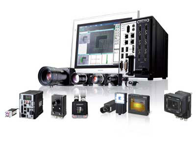
Machine vision refers to the technology and methods used to provide imaging-based automatic inspection and analysis for applications such as automated inspection, process control, and robot guidance. It involves capturing and processing visual information using cameras and computers. The main components of a machine vision system include cameras, lighting, image processing software, and sometimes specialized sensors. Machine vision excels in tasks requiring detailed visual information, such as quality control, product inspection, and complex pattern recognition. Machine vision and LiDAR are two distinct technologies that play crucial roles in modern automation and robotics. Understanding their differences is essential for choosing the right tool for specific applications.
Definition of LiDAR
LiDAR (Light Detection and Ranging) is a remote sensing technology that utilizes laser pulses to measure distances by calculating the time it takes for the light to reflect off an object and return to the sensor. This process allows LiDAR to create highly accurate 3D maps of the surrounding environment, providing precise spatial information. One of the standout features of LiDAR is its effectiveness in low-light conditions, as well as its ability to penetrate obstacles like fog and rain. This makes it highly reliable for applications where accurate spatial information is critical.
LiDAR is widely used across various industries. In autonomous vehicles, it plays a crucial role in mapping the environment, detecting obstacles, and aiding navigation. Drones equipped with LiDAR can conduct detailed surveys and environmental monitoring, mapping forests, and assessing vegetation heights. Urban planners use LiDAR for creating detailed maps of cities, facilitating infrastructure development and planning. In agriculture, LiDAR supports precision farming by enabling detailed analysis of crop health and field conditions.
By providing a high level of accuracy and reliability, LiDAR has become indispensable in fields requiring detailed environmental mapping and spatial analysis. Its ability to operate effectively in various environmental conditions further enhances its utility across different applications.
Key Differences in Technology
The primary difference between machine vision and LiDAR lies in their sensing mechanisms and the type of data they generate. Machine vision systems rely on visual data captured by cameras, producing detailed images that can identify colors, textures, and patterns. These systems are highly effective in applications where visual detail is crucial, such as quality control and product inspection. However, they can struggle in poor lighting conditions, which can limit their effectiveness in certain environments.
LiDAR, on the other hand, uses laser pulses to provide precise distance measurements and create detailed 3D maps of the surroundings. This technology excels regardless of lighting conditions, making it highly reliable in low-light or adverse weather situations. Unlike machine vision, LiDAR does not capture visual details like colors and textures, which can limit its use in applications where these details are important.
Machine vision systems typically offer higher resolution images and are used for a broader range of applications requiring detailed visual information. They are ideal for tasks such as recognizing product defects, reading labels, and ensuring proper assembly. In contrast, LiDAR is indispensable for tasks that require accurate spatial data and 3D mapping, such as autonomous vehicle navigation, environmental monitoring, and urban planning.
By understanding these key differences, engineers can select the appropriate technology based on the specific requirements of their application, leveraging the strengths of each to achieve optimal results.
Applications and Use Cases
Machine vision is widely employed in manufacturing for tasks like quality control, product inspection, and assembly line monitoring. These systems ensure products meet precise specifications by identifying defects, verifying dimensions, and ensuring proper assembly. In healthcare, machine vision is crucial for diagnostic imaging, aiding in the detection of diseases through detailed image analysis. Logistics also benefit from machine vision through automated sorting and inventory management, enhancing efficiency and accuracy in warehouses.
LiDAR, with its ability to create detailed 3D maps, is indispensable in autonomous driving. It helps vehicles navigate safely by detecting obstacles and mapping the environment accurately, regardless of lighting conditions. Environmental monitoring is another critical application of LiDAR, where it is used to map forests, measure vegetation heights, and monitor coastal erosion. Urban planners utilize LiDAR to create detailed city maps, aiding in infrastructure development and disaster management. In agriculture, LiDAR supports precision farming by enabling detailed analysis of crop health and field conditions, optimizing yield and resource use.
Both technologies have distinct strengths that make them suitable for specific applications. Understanding these applications helps in leveraging the right technology for the desired outcome, ensuring efficiency, safety, and accuracy across various industries.
Future Trends and Developments
Both machine vision and LiDAR are experiencing significant advancements that promise to enhance their capabilities and expand their applications. In machine vision, the integration of artificial intelligence (AI) and machine learning is a game-changer. These technologies allow vision systems to become more accurate and adaptable, particularly in complex pattern recognition and decision-making processes. Emerging technologies like 3D vision and augmented reality (AR) are also broadening the scope of machine vision, enabling more interactive and immersive applications in fields like manufacturing, healthcare, and entertainment.
LiDAR technology is becoming more cost-effective and compact, making it accessible for a wider range of applications. Improvements in processing power and data handling are enhancing the efficiency and accuracy of LiDAR systems, allowing them to process vast amounts of data more quickly and effectively. The integration of AI and machine learning with LiDAR is leading to more sophisticated autonomous systems. For instance, in autonomous driving, these combined technologies are enabling vehicles to better understand and navigate their surroundings, improving safety and reliability.
These trends indicate a future where machine vision and LiDAR will play increasingly critical roles in various industries, driving innovation and improving performance. The continued evolution of these technologies will likely bring about new applications and capabilities, further embedding them into the fabric of modern technological solutions.
Conclusion
Machine vision and LiDAR are powerful technologies with distinct advantages and limitations. Machine vision excels in applications requiring detailed visual information and precise image analysis, while LiDAR is unmatched in providing accurate spatial data and 3D mapping capabilities. Understanding the differences and potential applications of each technology is crucial for leveraging their strengths in various fields. As both technologies continue to advance, they will play increasingly complementary roles in the development of innovative solutions across industries.