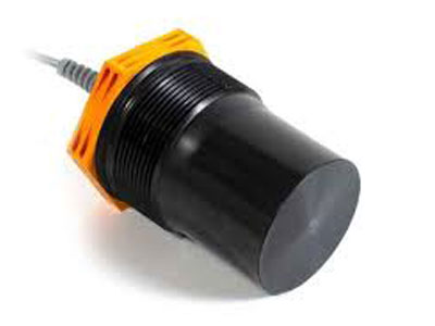
How to measure a long distance?
Key Takeaway
To measure a long distance, technologies like laser, radar, and LIDAR sensors are used. Laser sensors provide high accuracy and are suitable for both indoor and outdoor applications. They measure long distances by emitting a laser beam and calculating the time it takes to return after hitting an object. Radar sensors use radio waves to detect distances over long ranges, even in adverse weather conditions. LIDAR offers detailed 3D mapping by emitting laser pulses, making it useful for surveying and navigation.
Factors like environmental conditions, surface reflectivity, and obstacles can affect long-distance measurement accuracy. Integrating these sensors with Ethernet networks allows for real-time data communication, enhancing measurement precision and process control. This setup is commonly used in industrial automation, ensuring efficient monitoring and faster responses.
Overview of Long-Distance Measurement Techniques
Measuring long distances accurately requires advanced techniques and technologies that can handle vast ranges, varying environmental conditions, and the need for high precision. Long-distance measurement is crucial in industries like construction, surveying, robotics, and autonomous navigation, where accurate and reliable data is essential for safety and efficiency. The most effective methods for long-distance measurement include laser technology, radar, and LIDAR, each offering unique benefits based on the application’s requirements.
Traditional tools like measuring tapes and range finders have limitations in terms of range and accuracy, making them unsuitable for extended distances. In contrast, advanced sensors leverage Time-of-Flight (ToF) principles, which involve sending a signal (light or radio waves) to a target and calculating the time it takes for the signal to return. This allows for precise distance measurements over long ranges, often spanning hundreds of meters.

Using Laser Technology for Long-Distance Measurement
Laser distance measurement is one of the most popular methods for accurately measuring long distances. Laser sensors work by emitting a focused laser beam toward a target and then measuring the time it takes for the beam to return after reflecting off the target. This technique is based on the Time-of-Flight (ToF) principle, which offers high precision and rapid response times.
Laser sensors are widely used in construction, surveying, manufacturing, and logistics due to their millimeter-level accuracy and ability to measure distances up to several hundred meters. Here’s why they are effective:
High Accuracy: Laser sensors provide extremely accurate measurements, often with a margin of error as low as a few millimeters. This makes them suitable for applications that require detailed measurements, such as dimensional inspection, 3D mapping, and terrain analysis.
Long Range: Laser technology is capable of measuring distances up to several kilometers, making it ideal for large-scale applications like construction site mapping and geospatial surveying.
Fast Response Time: Laser sensors can take multiple measurements per second, offering real-time data that’s critical in dynamic environments like robotic navigation or automated vehicle guidance.
However, laser sensors can be affected by weather conditions, such as fog, rain, or dust, which can scatter the laser beam and reduce accuracy. Despite these limitations, their precision and range make them one of the most reliable tools for measuring long distances.
Role of Radar and LIDAR in Measuring Long Distances
Radar and LIDAR technologies are also effective in measuring long distances, each with distinct features that cater to specific applications:
Radar: Radar sensors emit radio waves that travel to a target and reflect back to the sensor. The sensor measures the time it takes for the waves to return and calculates the distance based on the speed of radio waves. Radar is particularly useful in measuring long distances in harsh environments, as it is less affected by conditions like fog, rain, or dust. It is commonly used in traffic monitoring, aviation, and military applications.
Long-Range Detection: Radar can measure distances up to several kilometers, making it suitable for large-scale applications like airport navigation and ship docking systems.
Environmental Tolerance: Radar works well in adverse weather conditions, providing reliable measurements in outdoor environments.
LIDAR (Light Detection and Ranging): LIDAR uses laser pulses to create a 3D map of the environment, measuring distances with high accuracy. It is widely used in autonomous vehicles, robotics, and geospatial mapping for its ability to generate detailed 3D models.
High Precision: LIDAR offers millimeter-level precision, making it ideal for terrain mapping, structural analysis, and autonomous navigation.
Real-Time 3D Mapping: LIDAR provides real-time data, allowing for accurate mapping and distance measurement in dynamic environments.
Radar and LIDAR offer robust solutions for long-distance measurement, with radar being more suited for all-weather conditions and LIDAR excelling in high-resolution mapping and precision applications.
Factors Affecting Long-Distance Measurement Accuracy
While advanced sensors offer accurate measurements over long distances, several factors can influence their performance:
Environmental Conditions: Factors like rain, fog, snow, and dust can affect the accuracy of long-distance measurement sensors. For instance, laser sensors may struggle in foggy conditions due to light scattering, while radar is generally more resistant to weather-related interference.
Surface Reflectivity: The reflectivity of the target surface can impact measurement accuracy. Highly reflective surfaces, like mirrors or polished metal, can cause the laser or LIDAR signal to scatter, leading to errors. In contrast, radar is less affected by surface reflectivity, making it suitable for detecting objects with varying textures.
Alignment: Proper alignment between the sensor and the target is crucial for accurate measurements. Misalignment can result in signal loss or inaccurate distance readings. Ensuring the sensor is positioned perpendicular to the target can help maintain accuracy.
Temperature Variations: Changes in temperature can affect the speed of light and sound, impacting the accuracy of laser and ultrasonic sensors. Advanced sensors come with temperature compensation features to ensure consistent performance in fluctuating temperatures.
Signal Interference: In industrial settings, interference from other electronic devices or machinery can affect the performance of long-distance sensors. Proper shielding and sensor placement can help minimize interference and maintain accuracy.
By understanding and addressing these factors, users can optimize the accuracy and reliability of long-distance measurements, ensuring that sensors perform well in a variety of conditions.
Integrating Long-Distance Measurement Sensors with Ethernet Networks
Integrating long-distance measurement sensors with industrial Ethernet systems enhances their functionality by enabling real-time data transmission, centralized control, and predictive maintenance. Ethernet-compatible sensors support communication protocols like Ethernet/IP, Profinet, and Modbus TCP, ensuring seamless connectivity with Programmable Logic Controllers (PLCs) and other networked devices.
Here’s how Ethernet integration improves long-distance measurement:
Real-Time Monitoring: Ethernet-connected sensors provide continuous feedback to control systems, allowing operators to make quick adjustments in processes like robotic navigation, site surveying, or traffic monitoring.
Centralized Control: Integrating sensors into Ethernet networks enables centralized control, where multiple sensors can be managed from a single interface. This improves efficiency and helps operators monitor and control sensors in real time.
Predictive Maintenance: Ethernet integration supports predictive maintenance by enabling continuous monitoring of sensor performance. This helps detect potential issues like calibration drift or signal interference, prompting timely maintenance and minimizing unexpected downtime.
Ethernet integration not only enhances measurement accuracy but also improves the overall reliability and efficiency of automation systems, making it an essential component in modern industries.
Conclusion
Measuring long distances effectively requires a combination of advanced techniques like laser, radar, and LIDAR technologies. Each method offers unique advantages, from high accuracy and long-range detection to robust performance in challenging environments. By understanding factors that affect accuracy and integrating sensors with industrial Ethernet systems, industries can achieve reliable, real-time distance measurement, ensuring safe and efficient operations.
